
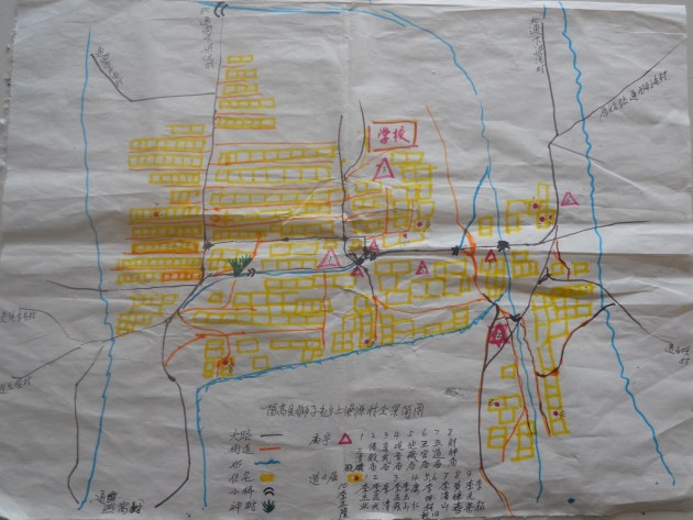
Map of Upper Liangyuan village, Li Manshan 2012, showing former temples and the houses of Daoists.
As you may notice in my series of reports on local ritual, fieldwork often oscillates between various geographical levels, all mutually beneficial—zooming in with thick description, or out to sketch the wider picture.
Dong Xiaoping reflected on this issue in a thoughtful review of field reports on west Fujian (in Overmyer, Ethnography in China today, pp.347–50), commenting again on the old “unity and diversity” theme in Chinese culture.
We need a balance between “making a base” (dundian) and “surveys” (pucha). My two detailed long-term projects on Gaoluo village and the Li family Daoists have both benefitted from surveys of the wider regional culture of which they are part.
Thus, in my writings as in the wider literature, one can find studies of
- A whole province (like Fujian or Ningxia), or a municipality (like Tianjin)
- One region, like Shaanbei, south Shaanxi, or southwest Shanxi
- One county, like Yanggao (for other Daoist groups there besides the Li family, see here; for a wide range of personalities, see here); or Shuozhou (and most pages under Local ritual)
- One village, like Gaoluo
- One individual or family, like Li Manshan and the Li family (main subject of this blog).
My posts on local ritual illustrate all this with many maps. The more we zoom in, the more satisfying the results; but the broader picture is necessary too.

大小通吃
LikeLiked by 1 person
Pingback: A 1956 fieldtrip to Hunan | Stephen Jones: a blog
Pingback: Fujian, 1961 and onwards | Stephen Jones: a blog
Pingback: Italy: folk musicking | Stephen Jones: a blog